maps subject index
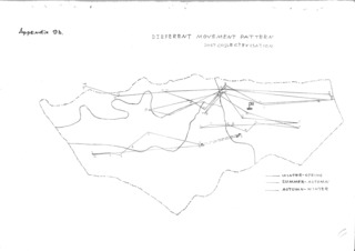
Map of household mobility in Uvs
Erdenebaatar, B
Taken from Erdenebaatar’s report on mobility patterns (Appendix 9b). This map contrasts the different mobility strategies of post-collective households
subject: mobility patterns, maps
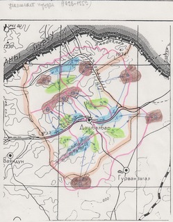
Map of “traditional” mobility patterns in Dashbalbar
Batbuyan, B
This map depicts the “traditional” mobility patterns (1936-1959) described by research collaborators in Dashbalbar.
subject: mobility patterns, maps
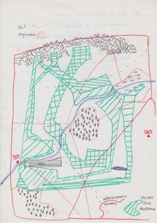
Sneath-migration-zones-sketch-map
Sneath, David
subject: maps
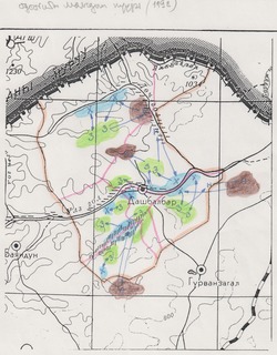
Map of contemporary mobility patterns in Dashbalbar
Batbuyan, B
This map depicts the contemporary mobility patterns described by research collaborators in Dashbalbar.
subject: mobility patterns, maps
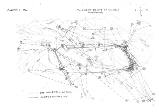
Map of movements among participant households in Uvs
Erdenebaatar, B
Taken from Erdenebaatar’s report on mobility patterns (Appendix 9a). This map contrasts collective-era and post-collective mobility patterns among households who participated in ethnographic research.
subject: mobility patterns, maps
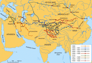
Expeditions of Sven Hedin
Unknown
Map depicting the routes of Sven Hedin’s exploring expeditions, 1886-1935.
subject: expeditions, maps
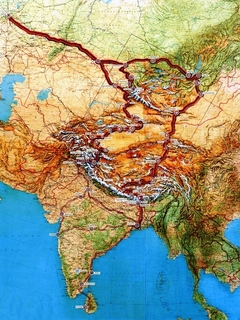
Map of NK Roerich’s Central Asian expeditions
Roerich Museum
Map showing the expedition routes of NK Roerich, from the Roerich Museum.
subject: expeditions, maps
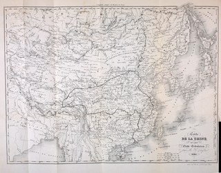
Map of Evariste Huc’s travels
Dufour, H
Map accompanying “Souvenirs d’un voyage dans la Tartarie, le Thibet et la Chine”, Evariste Huc, 1850
subject: expeditions, maps
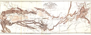
Central Asia from Peking to Yarkand and Kashmir via the Mustagh Pass: Illustrating the journeys of Captain F. E. Younghusband, Kings Dragoon Guards
Murray, John
A map showing the route of Frank E Younghusband on his trip from Beijing to Kashmir.
subject: expeditions, maps
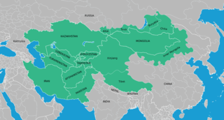
Map of Inner Asia
MIASU
Map showing the region taken as “Inner Asia”, prepared by the Mongolia and Inner Asia Studies Unit, Department of Social Anthropology, University of Cambridge.
subject: Inner Asia, maps

Map of the Ethno-Linguistic groups of Central Asia
CIA; Wikimedia Commons User:Pmx
Ethno-linguistic map of Central Asia
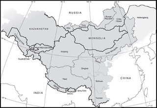
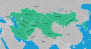
Map of Inner Asia (SRI)
Thrift, Eric
Map of Inner Asia, locating the extent of the area studied by the Sinor Research Institute for Inner Asian Studies, located at Indiana University in the USA.
subject: Inner Asia, maps

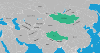
Map of Inner Asia (MONDEA)
Thrift, Eric
This map shows the Mongolian areas of Inner Asia that are represented in the Mongolian Digital Ethnography Archive.
subject: Inner Asia, maps
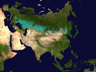
Approximate extent of the Eurasian Steppe grasslands ecoregion, and Eurasia cultural region
Wikimedia Commons User:Clivius; Wikimedia Commons User:Cp6; Wikimedia Commons User:Shattered Gnome
Approximate extent of the Eurasian Steppe grasslands ecoregion, and Eurasia cultural region.
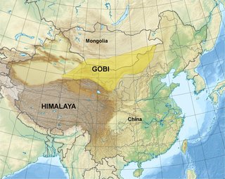
Map of the Gobi Desert
Cagé, Christophe
Map showing China, Mongolia, the Himalayas, and the Gobi region
Map of High Asia
Thrift, Eric
Map of “High Asia” (French “Haute Asie”, Russian “Tsentral’naia Aziia”).
subject: Inner Asia, maps

A Map of Western Tartary Drawn from the Survey of the Jesuits and Mr. Kyrillow's Map of the Russian Empire
Kitchin, Thomas
A fascinating 1747 European mapping of the Gobi Desert and the eastern portion of the Silk Route region by Thomas Kitchin.
subject: Gobi, maps, silk route
Map of Inner Asia (CIAS)
Thrift, Eric
Map of Inner Asia, locating the extent of the area studied by the CIAS at the University of Toronto.
subject: Inner Asia, maps

Witsen - map of Tartaria
Witsen, Nicolaes
Tartaria, sive magni Chami Imperium ex credendis amplissimi viri, Amsterdam 1705