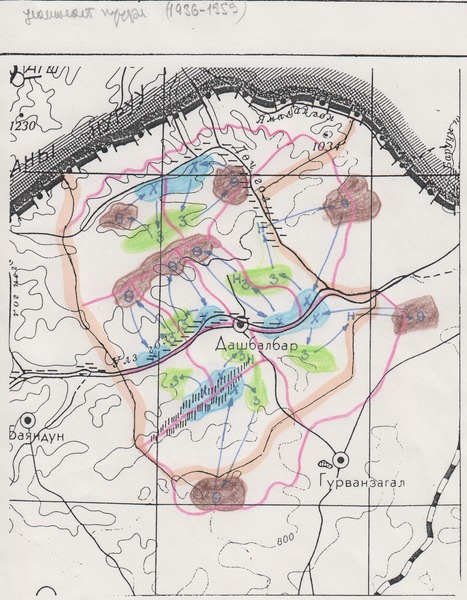
Map of “traditional” mobility patterns in Dashbalbar
Metadata
collection
Environmental and Cultural Conservation in Inner Asia
identifier
eaf5b0b6-2f10-4954-bf12-54ff67248934
creator
type
coverage
description
This map depicts the “traditional” mobility patterns (1936-1959) described by research collaborators in Dashbalbar. The sum centre is depicted in the middle of the map; seasonal grazing areas are labelled as follows: summer (З) and autumn (Н) – green, winter (Ө) – brown, spring (Х) – blue. Blue arrows depict the direction of movement.
source
Scanned from an original document held in the archives of the Mongolia and Inner Asia Studies Unit, University of Cambridge.
subject
date
1993
language
files
| metadata-en | docx | 132.4 KiB | 2018-01-09 17:07:00 |